Trail Walking Le Sappey-en-Chartreuse - Belvédère de Roche Rousse en circuit - Photo

Belvédère de Roche Rousse en circuit

 Emelle
Emelle

User

© OpenStreetMap contributors
Length
Length
12.7 km
Max alt
Max alt
1660 m
Uphill gradient
Uphill gradient
700 m
Km-Effort
Km-Effort  
22 km
Min alt
Min alt
997 m
Downhill gradient
Downhill gradient
700 m
Boucle
Boucle
Yes
Creation date :
2022-11-20 08:15:22.148
Updated on :
2022-11-25 08:57:10.419

(0 Reviews)

Walking
Walking
5h30
Difficulty : Medium

Scan this QR Code to open this trail in the SityTrail application

FREE GPS app for hiking

Logo SityTrail SityTrail

IGN / Geographical institutes

Download SityTrail from the App Store Download SityTrail from Google Play

Logo SityTrail SityTrail World

The world is yours!

Download SityTrail from the App Store Download SityTrail from Google Play Download SityTrail on Huawei AppGallery

About

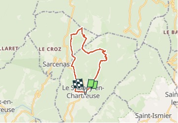
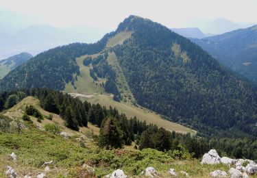
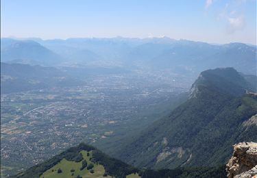
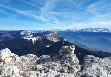
Trail Walking of 12.7 km to be discovered at Auvergne-Rhône-Alpes, Isère, Le Sappey-en-Chartreuse. This trail is proposed by Emelle.

Description

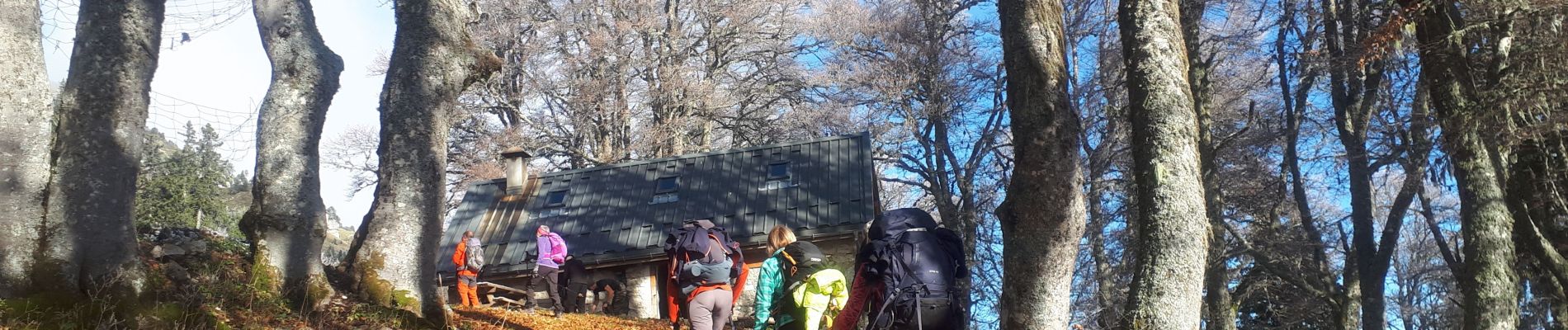
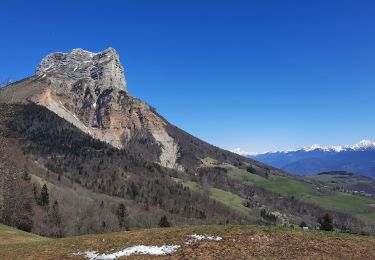
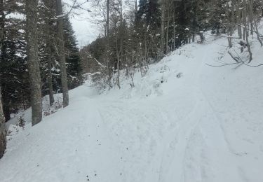
Jusqu'à le point de bifurcation pour le belvédère de Roche Rousse, on a eu le soleil et sentier sec à la montée avec une poudreuse après.
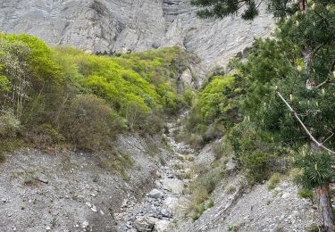
Le tracé n'intègre pas l'AR au belvédère de Roche Rousse car je suis restée avec le groupe qui ne l'a pas fait. l'AR est débonnaire et sans difficulté sauf qu'il faut remonter au retour.
Neige croutée en versant ouest et un passage verglacé sous la fontaine de Bachasson. Donc attention de ne pas proposer cette randonnée trop tard en saison.

Elevation profile

Photos

Positioning

Country:
France
Region :
Auvergne-Rhône-Alpes
Department/Province :
Isère
Municipality :
Le Sappey-en-Chartreuse
Location:
Unknown
Start:(UTM)
718030 ; 5015417 (31T) N.

Trails nearby

Trail Walking Saint-Nazaire-les-Eymes - Chateau-Nardent par le C9 - Photo
Walking
GuyVachet

Walking

Difficult
(2)
Saint-Nazaire-les-Eymes, Auvergne-Rhône-Alpes, Isère, France
8.2 km | 17.7 km-effort
6h 23min
Yes
Trail Walking Corenc - Mont Saint-Eynard par le Pas Guiguet  - Photo
Walking
cmarit

Walking

Difficult
(2)
Corenc, Auvergne-Rhône-Alpes, Isère, France
10.9 km | 26 km-effort
6h 5min
Yes
Trail Walking Sarcenas - Chamechaude par le Jardin, depuis le Col de Porte - Photo
Walking
tracegps

Walking

Difficult
(2)
Sarcenas, Auvergne-Rhône-Alpes, Isère, France
10 km | 23 km-effort
6h 19min
Yes
Trail On foot Plateau-des-Petites-Roches - Tour de Pravouta - Photo
On foot
PRO

On foot

Easy
Plateau-des-Petites-Roches, Auvergne-Rhône-Alpes, Isère, France
3.9 km | 7.5 km-effort
1h 42min
Yes
Trail Walking Plateau-des-Petites-Roches - Dent de Crolles - Photo
Walking
simon.paume

Walking

Difficult
(1)
Plateau-des-Petites-Roches, Auvergne-Rhône-Alpes, Isère, France
8.4 km | 18 km-effort
3h 40min
Yes
Trail Touring skiing Proveysieux - 140124 Mont Fromage - Photo
Touring skiing
mzonzon05

Touring skiing

Easy
Proveysieux, Auvergne-Rhône-Alpes, Isère, France
8.5 km | 18 km-effort
3h 21min
Yes
Trail Walking Biviers - Cresancoche - Photo
Walking
NANE51

Walking

Easy
Biviers, Auvergne-Rhône-Alpes, Isère, France
3.3 km | 6.2 km-effort
1h 12min
Yes
Trail Walking Sarcenas - Chamechaude en circuit partiel au départ du col de Porte - Photo
Walking
Emelle

Walking

Medium
Sarcenas, Auvergne-Rhône-Alpes, Isère, France
7.2 km | 16.8 km-effort
4h 20min
Yes
Trail Walking Le Sappey-en-Chartreuse - Sappey_Fort st Eynard - Photo
Walking
Mich&Agnès

Walking

Easy
Le Sappey-en-Chartreuse, Auvergne-Rhône-Alpes, Isère, France
7.6 km | 15.5 km-effort
1h 48min
Yes


Close
My subscriptions